发表期刊:Journal of Cleaner Production
分区:SCI一区
影响因子:10.0
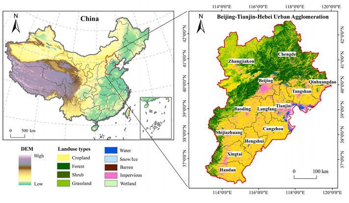
Under the combined effects of urbanization and global warming, urban high temperature has posed significant risks on urban human health and sustainable development, especially in highly urbanized metropolitan areas. Despite the importance and extensive literature on urban heat risk (UHR) assessment, little attention has been paid to investigating its driving mechanisms using interpretable machine learning models. Taking the Beijing-Tianjin-Hebei urban agglomeration (BTHUA) as the study area, this study employs the ‘Hazard-Exposure-Sensitivity-Adaptability’ (HESA) framework to establish a long-term, multi-scale dynamic evaluation indicator system. This system is used to assess the spatiotemporal evolution of summer UHR in BTHUA from 2000 to 2020. Based on this, we analyze the key indicators and mechanisms influencing UHR at the urban agglomeration, provincial, city, and urban-rural scales, using an explainable machine learning model. The study reveals that the BTHUA exhibits a distinct spatial pattern of UHR, characterized by a gradual decrease from the urban core towards the periphery. Furthermore, high UHR areas have shown a temporal shift from north to south. Land surface temperature (LST) displays significant spatial heterogeneity, and the underlying driving mechanisms demonstrate notable scale dependence and regional variation. LST consistently remains the dominant factor. Except LST, Normalized Difference Vegetation Index (NDVI) is a key indicator in core cities like Beijing and Tianjin. In contrast, the ecological regulatory effect of water bodies and vegetation is more pronounced in some cities of Hebei. At the urban-rural scale, child density (CD) is the primary indicator in urban areas, while the influence of medical service distance (MSD) and NDVI strengthens progressively towards rural areas. This study demonstrates that the formation of UHR results from the complex interplay between natural conditions and the human built environment, with its driving mechanisms undergoing systematic transitions across spatial scales and regional function. This study explores the long-term impact of UHR at cross-scale in BTHUA and identifies key impact indicators, which is of great significance for urban planning and the formulation of cooling strategies.